Sansar Raj Meena
AI and Earth observation for geohazards · Researcher at OGS, Trieste · Geophysics Department, SpatioAI Lab

Borgo Grotta Gigante 42/C
34010 Sgonico (TS), Italy
Ciao! 👋
I am a geoinformatics researcher from India working on artificial intelligence for geohazards. I build deep-learning models that map landslides and their impacts from satellite and aerial imagery, train Earth-observation foundation models on large unlabelled image archives, and use satellite radar, including the new NASA–ISRO NISAR mission, to measure how slopes move before and after they fail.
At OGS in Trieste I am the Principal Investigator of NATURA, a five-year Starting Grant of the Italian Science Fund (FIS 3, 2026–2031) that combines AI, physically based modelling and socio-economic analysis to understand the natural and anthropogenic drivers of landslide risk in mountain regions.
Before OGS I was a researcher at the Department of Geosciences, University of Padova, in the Machine Intelligence and Slope Stability Laboratory, and at ITC, University of Twente, and a visiting scientist at Boston University. I obtained my PhD in Applied Geoinformatics from the University of Salzburg (Z_GIS), on deep learning for rapid landslide mapping, and my MSc in Geo-Information Science and Earth Observation from ITC, University of Twente.
Click here to know more about my work. To get in touch, send an email to smeena[at]ogs[dot]it.
featured research
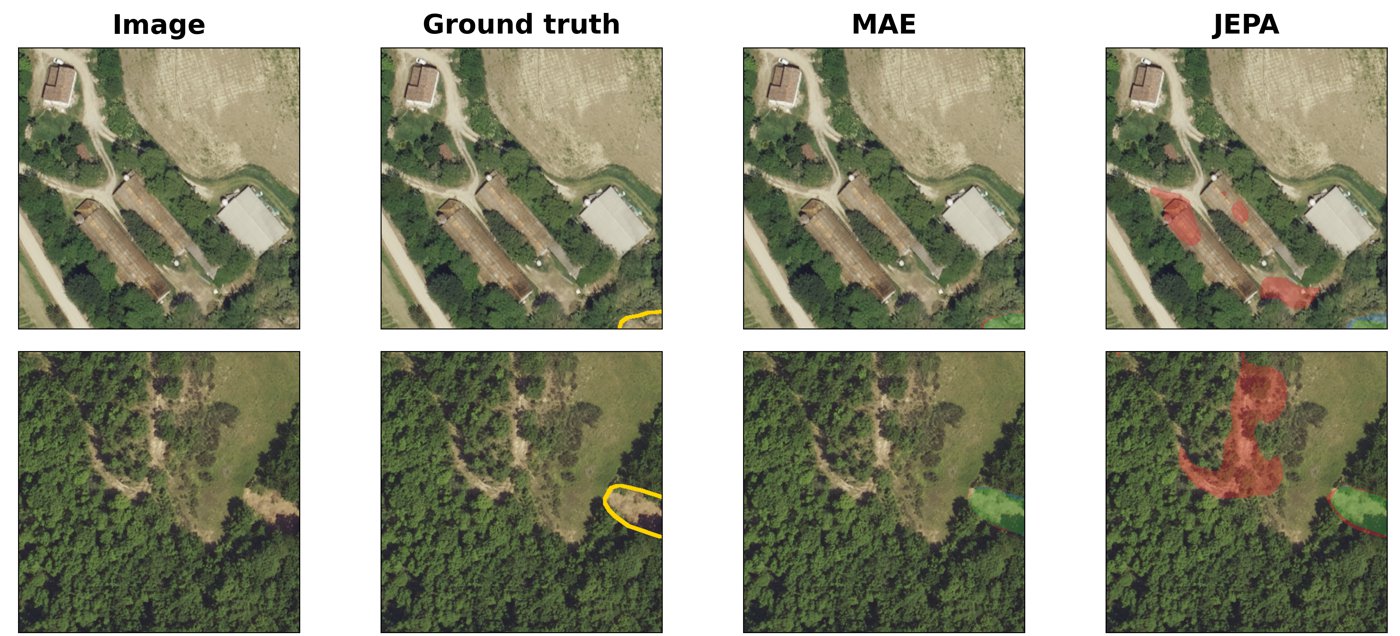
Which self-supervised objective learns landslides? MAE vs JEPA
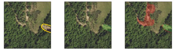
With Xiaochuan Tang and Filippo Catani, I trained two vision-transformer foundation models from scratch, a masked autoencoder (MAE) and a joint-embedding predictive variant (JEPA), on 4.85 million unlabelled 0.2 m aerial patches of Emilia-Romagna spanning 1976–2023, and compared them for landslide segmentation with frozen encoders from 1 % to 100 % of the labels. Under that frozen-probe protocol MAE outperformed JEPA at every label fraction, a hint that masked reconstruction keeps the fine morphology of scarps and deposits that landslide mapping needs. A fully fine-tuned supervised SegFormer-B2 is still stronger, and the paper says so. Both 867-million-parameter encoders are released as open weights, the losing JEPA model included, so the comparison can be checked.

Can NISAR see an ice–rock avalanche coming?
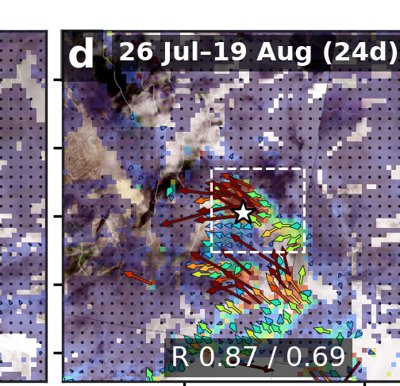
On 26 August 2026 an ice–rock avalanche above the Bhote Koshi in Nepal sent a debris flow down the Bhote Koshi–Trishuli valley. I analysed all five NASA–ISRO NISAR L-band pixel-offset pairs spanning the event. The last pre-event pair shows 0.96 m of median downslope motion at the source in 24 days, but no interval stands out against size-matched regions nearby, the rate does not accelerate, and the pair spanning the failure decorrelates. A footprint-wide screen finds the source among 101 zones of downslope motion, most of them glaciers. Motion at a future source is measurable before failure; on its own it is not diagnostic of failure.
news
| Sep 24, 2026 | New preprint on EGUsphere: NISAR pixel offsets measure but do not statistically resolve pre-failure motion at the 26 August 2026 Bhote Koshi ice–rock avalanche, Nepal. |
|---|---|
| Sep 22, 2026 | Full NISAR study posted on Research Square: NISAR offsets measure pre-failure motion but do not single out the Bhote Koshi avalanche source. |
| Aug 21, 2026 | Released open weights for the two 867M-parameter ChronoSat encoders (MAE and JEPA) on Zenodo, CC BY 4.0.  |